ESRI, creators of leading location intelligence technology, have released ArcGIS Reality, their new tool for high-precision 3D mapping.
ArcGIS Reality is a set of products that, using the new ArcGIS Reality Engine, will aid in generating 3D models or ‘digital twins’ and high-resolution maps of construction sites, cityscapes, or even entire nations using imagery data.
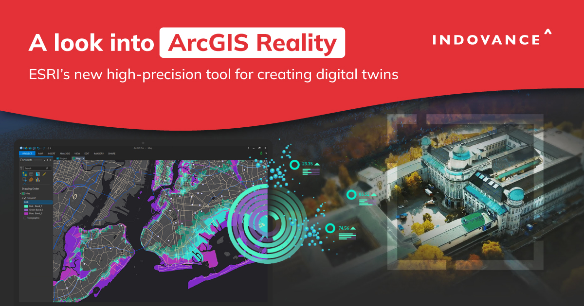
With the introduction of ArcGIS Reality, a reality capture addition to its flagship GIS platform, Esri is advancing traditional GIS into the BIM digital twin and 3D space.
The ArcGIS Reality Suite – Products under ArcGIS Reality
AEC (Architecture, Engineering, and Construction) businesses often encounter a number of challenges when generating Digital Twins like accuracy issues, integration with physical systems, and more.
ArcGIS Reality, with its set of products, provides a reliable solution to these problems. It collects and integrates data from a variety of sources, including LiDAR scans, aerial imagery, and IoT sensors to generate accurate digital twins of different physical assets and environments.
ESRI has introduced four products with ArcGIS Reality:
- ArcGIS Reality for ArcGIS Pro: An extension of Esri’s flagship desktop GIS software. It will allow users to input images from drones/UAVs and generate 3D outputs for reality mapping.
- ArcGIS Reality Studio: A new application that focuses on reality mapping from aerial images for entire cities and nations. Its user-friendly interface allows users to deliver survey-grade representations efficiently.
- Site Scan for ArcGIS: Esri’s cloud-based end-to-end reality mapping software for drone imagery, designed to simplify drone program management, imagery data collection, processing, and analysis.
- ArcGIS Drone2Map: A desktop application that focuses on reality mapping from drone imagery, thus enabling offline processing and in-the-field rapid mapping.
The products can be leveraged to create accurate digital twins of various physical assets and environments, thus proving highly beneficial for AEC businesses globally. With ArcGIS Reality, organizations can gain a deeper understanding of their physical assets, leading to improved decision-making, increased operational efficiency, and enhanced collaboration.
Step into a New Dimension: Here’s how ArcGIS Reality proves beneficial for AEC businesses globally
Esri Takes 3D Mapping to the Next Level with ArcGIS Reality
ArcGIS Reality is a platform from Esri that provides a powerful suite of tools for the Architecture, Engineering, and Construction (AEC) industry. ArcGIS Reality is a set of products from Esri that uses the ArcGIS Reality Engine for site, city, and national reality mapping.
With the help of detailed imagery data, which extracts information from every pixel to create dynamic digital representations of the world, operations and opportunities are made visible. Organizations can analyze and interact with a digital world that accurately depicts places and situations as they are using 3D models and high-resolution maps of construction sites, intricate cityscapes, or entire countries.
This ArcGIS Reality software can help AEC businesses globally in several ways:
- Improved collaboration: ArcGIS Reality provides a shared, cloud-based platform for stakeholders to access, view and collaborate on project data, ensuring everyone is working with the latest information.
- Enhanced visualization: The platform provides high-quality 3D models and interactive visualization tools that can be used to showcase designs and proposals to clients and stakeholders, helping to build a better understanding and win support.
- Streamlined workflows: ArcGIS Reality provides a suite of tools and workflows to help streamline processes, such as project planning, design, and construction, reducing the risk of errors and rework.
- Improved decision-making: The platform provides data-rich visualizations and insights that can help teams make informed decisions quickly and with confidence.
- Increased efficiency: By providing a centralized platform for project data and collaboration, ArcGIS Reality helps to reduce the time and effort required to manage projects, leading to increased efficiency and cost savings.
ArcGIS Reality is a useful tool for AEC companies worldwide since it helps with collaboration, visualization, processes, decision-making, and efficiency, which results in improved outputs and increased competitiveness.
3D models and high-resolution maps of construction sites, intricate cityscapes, or entire nations transform into digital twins of reality when geospatial data is added, such as cadastral surveys, utility networks, building information models (BIM), and real-time sensor data. This facilitates a deeper comprehension of the world through analysis, asset monitoring, or even predictive simulation.
What is a Digital Twin and how it benefits the AEC Industry
In the simplest terms, a Digital Twin is the 3D virtual representation of a physical asset containing a wealth of information like technologies associated with the asset, sensors used, space utilization, and more.
Digital Twin of an asset proves highly beneficial for AEC firms
This multi-dimensional representation proves crucial for AEC firms as it allows them to study its performance, impact of changes, space utilization, and more.
Here are the benefits of generating a Digital Twin-
- Enhanced product design: Product and system designs can be optimized using a Digital Twin.
- Maintenance: Real-time monitoring of assets using digital twins enables businesses to anticipate and stop possible faults.
- Remote monitoring and control: Digital twins allow remote monitoring and control of assets, thus eliminating the need for on-site visits and reducing.
- Increased safety and security: It is important to consider the hazards associated with the construction industry. With a digital twin, businesses can effectively identify accident-prone areas on a construction site.
- Increased innovation: Digital twins give businesses the creative freedom to experiment with new ideas, technologies, and processes that can be implemented on the asset.
By enabling these benefits, digital twins are driving increased efficiency, collaboration, and innovation. As more organizations adopt this technology, the impact of digital twins on workflows will only continue to grow.
According to Fortune Business Insights, the aerial imaging market is expected to grow from $1.4 billion in 2017 to over $4 billion by 2025.
Talking about Digital twins and the release of ArcGIS Reality, Jack Dangermond, Esri Founder and President said “Digital twins have become a critical tool for many industries, and to be effective they rely on highly accurate and up-to-date maps and 3D models derived from imagery. We are happy to offer this new family of products to the professionals who are digitizing our world to help us all better understand it—whether their operations are large or small, local, or global.”
Follow Indovance Inc for AEC Industry Updates and Global Construction News.
About Indovance
Indovance Inc with its exclusive delivery hub in India is a global CAD technology partner serving the needs of the AEC industry since 2003. We focus on the unique need of each project or client and believe in addressing the real challenges and guarantee that the process will be well-coordinated, smooth, efficient, and hassle-free.
We collaborate with our customers around the world to develop bespoke business solutions using our enormous engineering talent pool and state-of-the-art technology. To deliver long-term engineering and business strategies, we align with your culture and processes to create an unbreakable partnership. With over 550 full-time employees and more than 600 customers in the US, Europe, India, and Asia, we are poised for the next level of success.
Indovance acts as a catalyst, Empowering You for positive change and supporting you to Do More.
For more queries regarding any of the above-mentioned topics, feel free to connect with us on our website www.indovance.com, or contact us on +1-919-238-4044


